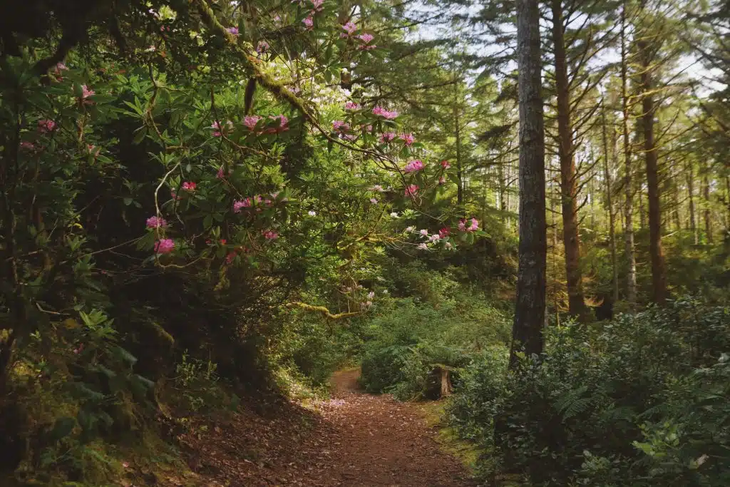
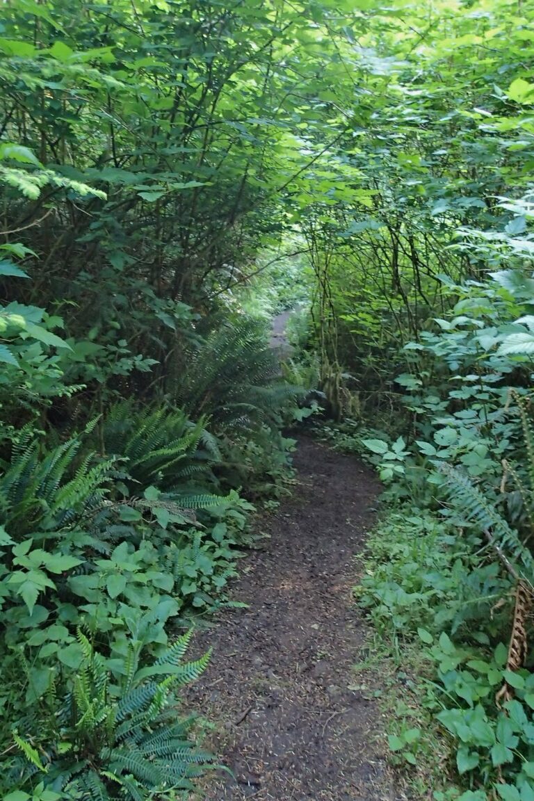
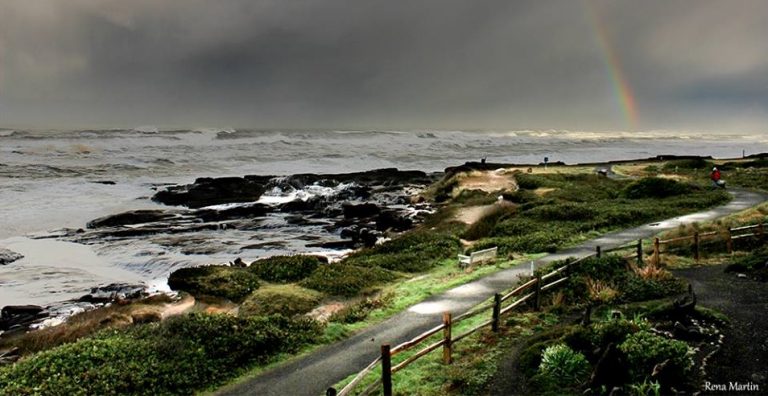
Hike, bike and walk

Considering the fact that we are a quaint coastal village, it's absolutely incredible how many stunning trails there are in the area! We also are extra lucky because we receive generous help from a dedicated group of local volunteers known together as-Yachats Trails. Year round they work hard to maintain our trail systems, which benefits visitors and locals alike, of all species. Thank you Yachats Trails!

One of the most popular walks in town, is the 804 Trail, which is a 1.7mi semi paved trail that goes from a flat sandy beach on the north side of town, to Yachats State Park. This historic trail boasts epic coastline views, tidepools at low tide, fantastic wave watching and whale watching, all on an easy walk. 

Another famous hike in the area, is the Amanda Trail- a memorial to the Indigenous people of the area, and a tribute to Yachats dark past. The full hike is about 7.5mi from Yachats to the top of Cape Perpetua, but you can hike pieces of it as well. Revel in deep emerald old growth forests, a skunk cabbage bog, amazing coastline vistas, a brand new suspension bridge, and of course, Amanda's Grotto. This hike is moderately challenging with a lot of switchbacks and uneven terrain, but well worth it.

Other trails we highly recommend include, but aren't limited to- Gerdemanns Garden, Cooks Ridge, Whispering Spruce, Ya'Xaik Trail, Yachats Wetlands, Saint Perpetua Trail, Trail of Restless Waters, Cape Cove, and of course a sunset walk along Yachats Ocean View Drive.

Featured Trails

Amanda Trail

This trail is dedicated to the memory of Amanda, a blind Coos woman who suffered injustices during the reservation years in the 1860’s. The north trailhead is at the south end of Yachats Ocean Road. From here it is a moderate hike of approximately 1.0 miles to the site of the Amanda statue. From Yachats Ocean Road, walk south along the path on the west side of Highway 101 until you reach Windy Way. Here the trail crosses the highway to the east side and enters lush coastal woodland with occasional panoramic ocean views. After crossing two driveways the trail reenters the forest and passes a statue of two bears. When the trail reaches a steep driveway, walk a short distance up it and then follow the trail sign to the right. A short walk will bring you to the site of the Amanda statue. Read about Amanda on the nearby interpretive signs. Cross Amanda Creek on a spectacular, high-level suspension bridge and continue south for a strenuous climb of 2.2 miles to the Cape Perpetua lookout. Parking is available there (pass required), so that if two cars are available, a small group can do a one-way hike.

  • 3.2 miles one way

  • 2 hours one way

  • Moderate to Amanda Statue

  • Difficult from Statue to Summit

  • No Bikes

Oregon Coast Trail

The complete Oregon Coast Trail extends from the California border in the south to the Columbia River. Through Yachats, the OCT includes the Amanda trail and the 804 Trail, both described elsewhere on this page. The section that links these two trails is an easy one-mile stroll from the south end of Yachats Ocean Road to the junction of Highway 101 and Ocean View Drive. Most of the trail is along the ocean front, with several benches at which you can stop and enjoy the panoramic views. At Yachats Ocean Road State Park there are convenient steps down to the beach. From the north end of Yachats Ocean Road, the trail briefly follows Highway 101 across the Yachats River to Ocean View Drive.

804 trail

The 804 Trail begins at the south end of Ocean View Drive, where it meets Hwy 101. The name derives from the distance between Yachats and Waldport, supposedly 8.04 miles. Starting out along Ocean View Drive toward the ocean, it travels north through the Yachats and the Smelt Sands State Parks and ends at some seasonal stairs that descend to a 7-mile stretch of sandy beach. Along the way are expansive ocean vistas and access to tide pools. At low tide, the hard beach sand makes for excellent walking. If you are arriving by car, either of the state parks would make a good starting point. The cliff path from Aqua Vista to the Adobe Resort traverses private property. Please respect the owners’ privacy.

  • 1.9 miles along beach

  • Easy

  • Easily Accessible

  • 1 hour one way

Ya’Xaik Trail

Beginning at the east end of Diversity Drive, this trail traverses lush second growth forest, linking to the Gerdemann Botanic Preserve’s public footpath that comes out on Highway 101. While dogs on leash are allowed on the Ya’Xaik trail, they are not allowed in the Gerdemann. When you reach Highway 101, head south to complete the loop at Diversity Drive. There is also a connecting trail from the 804 Trail (between the Fireside Motel and the Overleaf Lodge) that leads to the trailhead on Diversity Drive. (Ya’Xaik is the only known name of a southern Alsea village in the Yachats area that existed for at least 7000 years.)

  • 0.9 mile loop

  • 30 minute loop

  • Moderate with some steep stair inclines

  • No Bikes

Prospect Trail

Starting at Prospect Street near its intersection with E 2nd Street, the trail winds up through the Prospect Garden where there are many native plants growing. The trail climbs steeply, crossing 3 rd Street and King Street* before ending at Radar Road. You can now retrace your steps or walk down Radar Road to 7 th Street and then to King Street. Turn right (north) on King Street which takes you to a cemetery and down to Highway 101. From here you can access the 804 Trail via the grounds of the Adobe Resort. The climb to Radar Road is strenuous, with steps. *On reaching King Street, if you were to turn right and follow King to its terminus, you would reach a short footpath that connects to Horizon Hill Road.

  • 0.2 miles one way

  • 15 minutes one way

  • Steep

  • No Bikes

Yachats Community Park & Wetland

The Community Park lies behind (to the west of) the Yachats Commons building. Here you will discover a network of trails, including a boardwalk that skirts a pond and several paths through an urban forest. These trails connect to 4th Street, 5th Street (at the Yachats Commons), 7th Street (at the library) and Ocean View Drive.

  • 0.4 miles total

  • 20 minutes total

  • Easy, Level

  • No Bikes

Safety information

Research the route's length and difficulty.  Understand the predicted weather conditions.  Beware of incoming tides so you don't get stranded on rocks or beaches.  Learn about sunrise and sunset times.  Drive cautiously on logging roads and stay out of the way of log trucks.  Cyclists yield to hikers, and both yield to equestrians.  If you get lost, STOP!  Move to a clearing, put on bright colors, blow your whistle, and stay in one place so searchers can find you.  Tell someone where you are going and when you plan to return.  Always contact them when you return.  For details on where to hike, ride or paddle, contact the local information center if you are unsure about what you can and can't do in a given area. 

Bring these lifesaving "10 Essentials" on every outing

  • Compass and map.  Leave the electronic compass at home.  No battery or satellite service means no compass

  • Flashlight and extra batteries

  • Water and food

  • Waterproof matches

  • Fire starter

  • Bright, visible layered clothing for rain protection and warmth

  • Pocket knife

  • First aid kit

  • Whistle

  • Identification and the emergency medical information